2talltim Posted May 1, 2016 Report Share Posted May 1, 2016 If you need a place to camp Friday and Saturday, I can give you the address of our cabin and I'm sure you can throw a tent there or we may have a couch. It's around Robinsville NC Quote Link to comment Share on other sites More sharing options...
Connie14 Posted May 2, 2016 Report Share Posted May 2, 2016 1 hour ago, Chuck78 said: Ahhhhwwwww f%=!#&*! $#!+ dangit!!! Maybe we'll spend a bit more time in Red River Gorge with a group of fellow vintage bike geeks then, hang around Ashville a bit longer, and then make it to Maggie Valley Sunday when I hope most of the Harley owners trailer their trailer queens back and get back to their day jobs...assuming most of them are middle aged and not retired slo-pokers!!!! May 13-15th??? Dangit. Good info to know. Will stay away as best as we can. Stick to the twisty roads (except tail of the dragon) and avoid shitty bars, and you will be just fine. The shitty bars will be filled with HDs. Quote Link to comment Share on other sites More sharing options...
Chuck78 Posted May 2, 2016 Author Report Share Posted May 2, 2016 Yes. exactly what I'm trying to avoid. Really, anytime I go on vacation, I'm primarily trying to avoid most people in general & stick to the wilderness areas. With the exception of AMA Vintage Motorcycle Days weekend... then all the crazies come out, as well as all the Vintage Bike geeks, and a thousands of awesome bikes. Camping there is off the hook after the event is closed at 5pm Fri& Saturday Quote Link to comment Share on other sites More sharing options...
2talltim Posted May 2, 2016 Report Share Posted May 2, 2016 Ive got a new seat, new lowered pegs, helmet and GPS on the bike this year. Can't wait for this first long trip to break them all in. Quote Link to comment Share on other sites More sharing options...
Tonik Posted May 2, 2016 Report Share Posted May 2, 2016 15 minutes ago, 2talltim said: Ive got a new seat, new lowered pegs, helmet and GPS on the bike this year. Can't wait for this first long trip to break them all in. You should be nicer to me. Today, just for you I bottled my best ever bourbon. 96 proof, added a touch of wheat to give it a little sweetness. Aged in oak. Its amazing. Really, this jar has your name on it. For now. Quote Link to comment Share on other sites More sharing options...
2talltim Posted May 2, 2016 Report Share Posted May 2, 2016 31 minutes ago, Tonik said: You should be nicer to me. Today, just for you I bottled my best ever bourbon. 96 proof, added a touch of wheat to give it a little sweetness. Aged in oak. Its amazing. Really, this jar has your name on it. For now. Mmmmmmmmm!!!!! But if i'm nice to you, you might think I don't like you anymore. Quote Link to comment Share on other sites More sharing options...
Chuck78 Posted May 2, 2016 Author Report Share Posted May 2, 2016 Tim, if you got that with you on your trip, you won't need a warm cabin with a warm bed and a warm hot tub! That'll be plenty to keep you warm in a sleeping bag, and make you forget how hard and rocky the ground is underneath you! Quote Link to comment Share on other sites More sharing options...
2talltim Posted May 2, 2016 Report Share Posted May 2, 2016 Quote Link to comment Share on other sites More sharing options...
Tonik Posted May 2, 2016 Report Share Posted May 2, 2016 Excelent point Tim, flame away. Quote Link to comment Share on other sites More sharing options...
Ron505 Posted May 2, 2016 Report Share Posted May 2, 2016 (edited) Here is a website with rides around the Maggie Valley area that a friend of mine put together. http://maggievalleyrides.com/index.html Edited May 2, 2016 by Ron505 1 Quote Link to comment Share on other sites More sharing options...
Chuck78 Posted May 12, 2016 Author Report Share Posted May 12, 2016 Here are some roads closer to the southern-most point I will be staying, any feedback on them? 276 was mentioned, & 209 etc: US441 to Little River Rd in the SmokY mountain National Park NC-209 & NC-63 around Hot Springs/Junaluska area NC-215 & US-276 (276 looks better on the map but reviews sound more favorable for 215 & surrounding backroads, what's your opinion?) NC-212 (apparently this super twisty desolate road is there just to give Appalachian Trail access?) 226&226a loop around the Little Switzerland area looks on the Google terrain view to be exactly my kind if road... Should I stick with those areas, or is it worth it to run 143 through Roan Mtn State Park, & 197 through Pisgah National Forest? 421 The Snake is north if there a ways but it looked great on a video I watched. Quote Link to comment Share on other sites More sharing options...
Chuck78 Posted May 12, 2016 Author Report Share Posted May 12, 2016 Lunchbreak notes added to the above post info: US441 to Little River Rd in the Smokies Hwy19 to BRP to: NC-215 & US-276. Visiting Skinny Dip Falls on BRP midway between 215&276 makes a nice triangle of roads NC-209 & NC-63 around Hot Springs/Junaluska area to: NC-212 (twisty/desolate paved Appalachian Trail access, turns to gravel at northeastern end) Buck Creek Rd to BRP NE to Little Switzerland, then: 226&226a loop around the Little Switzerland area looks on the Google terrain view to be exactly my kind if road... 143 through Roan Mtn State Park, & 197 through Pisgah National Forest? "Wayah Rd NC-1310 aka Thunder Rd, snaking it's way for 28 miles between Old Murphy Road near Franklin, NC and US19/74 at the Nantahala River Put-In, up & over the mountain...then head up the road to Franklin and pickup NC 28 north, in my opinion the best section of 28 is between Franklin and 74. The Hellbender." "WAYAH BALD: A side trip to Wayah Bald is well worth the effort. This vantage point is 5,342 feet in elevation. From Wayah Gap, journey 1.3 miles up gravel Forest Road 69 and see the Wilson Lick Ranger Station. Built about 1913, Wilson Lick was the first ranger station in the Nantahala National Forest. Continue another 3.2 miles up Forest Road 69 to Wayah Bald. Take the short paved trail to the historic Wayah Bald Fire Tower" Quote Link to comment Share on other sites More sharing options...
Tonik Posted May 12, 2016 Report Share Posted May 12, 2016 Just now, Chuck78 said: "Wayah Rd NC-1310 aka Thunder Rd, snaking it's way for 28 miles between Old Murphy Road near Franklin, NC One of the more epic roads down there. I have not been on that in a few years, they messed it up pretty bad when they chip sealed it. Have you been on it recently? Quote Link to comment Share on other sites More sharing options...
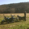
Chuck78 Posted May 12, 2016 Author Report Share Posted May 12, 2016 (edited) Nope, never. Suzuki GS forum guys highly recommended Wayah. Wayah & the Hellbender section of 28 were the only roads I was going out of the Asgeville/Maggie Valley area southbound-ish to ride. Tim/etc, If you see 2 riders on old Suzuki GS's, here's mine, stop and say hi! That was Reddish Knob, US33 WV VA border, & Smoke Hole Canyon. My last real ride last October. Edited May 12, 2016 by Tonik Fixed pics. Quote Link to comment Share on other sites More sharing options...
Tonik Posted May 12, 2016 Report Share Posted May 12, 2016 2 minutes ago, Chuck78 said: Nope, never. Suzuki GS forum guys highly recommended Wayah. Wayah & the Hellbender section of 28 were the only roads I was going out of the Asgeville/Maggie Valley area southbound-ish to ride. Cool, if you ride please let us know how it is. Quote Link to comment Share on other sites More sharing options...
2talltim Posted May 12, 2016 Report Share Posted May 12, 2016 I was on it last year, it was getting rough but still rideable at a moderate pace. Quote Link to comment Share on other sites More sharing options...
Chuck78 Posted May 21, 2016 Author Report Share Posted May 21, 2016 (edited) Brief recap highlights - on our way down from Ohio, we ran US23 most of the way to avoid the interstates. Camped just past Piketon KY in George Washington Jefferson National Forest in Virginia. Hit 23 again Sunday down to 619 (VA?) & were going to take that down to Little Switzerland to hit the Diamondback loop 226a & 226, then the Blue Ridge Parkway & Rt 80 Buck Creek Rd. 619 was AWESOME - narrow mountain road that looked more like it was exclusively just access to the High Knob lookout tower (awesome road - 10mph hairpins, dense forest, big climb to the top - great views at top lookout tower). Well just beyond the top and several gravel Forest service access roads to other Pisgah National Forest points of interest, 619 turned into a Forest Service gravel road of another name. Went down a bit until it got very steep and hit a 10mph gravel hairpin and the wife slid out & hurt her ego. Turned around and went back on 23 south. Very passable gravel if careful, JUST DONT FORGET OR PANIC AND HIT YOUR FRONT BRAKE!!!!!Continued South & got off 23 at (TN?) 352, nice road! Took it to (NC?)212 (same road different sate) which was awesome & fairly twisty, took a left on 208 (good&twisty) & then to Hot Springs, a very quaint little rustic town with people riding horseback through the streets like they were automobiles! City streets mo banners read "Hot Springs NC, An Appalachian Trail Community." Paid 60 cents per gallon more for gas there as its at the north end of 209 "The Rattler" with no other gas within 30-40 miles. 209 was AWESOME through Pisgah. Fresh pavement first 4 miles. Then patchwork after that where they take a section out half the lane width from the shoulder for 30-60 feet and repaved it. The first 5 miles here were like the Dragon but better, aside from loose asphalt cinders from patchwork in progress, & dodging gravel from trucks with trailers or busses wandering into the shoulder and kicking up gravel. Trucks with ANY trailers should not be allowed on this road at all... dragging gravel from the shoulder on the tight 15mph hairpins all over. This section was very tight and very awesome, mountain climbing a small mountain through a beautiful section of dense forest. Pisgah & Nantahala National Forests are awesome. 209 past that was a nice meandering winding valley road, then climbed over another foothill or smaller mountain which was good fun, but not as extreme as the other. This dumped us out near out destination of Maggie Valley NC's Wheels Through Time motorcycle museum where my wife was working the Wall of Death show this coming week/weekend. Camped with the crew, got to stay in the gatehouse cabin one night. Break in the rain, gotta pack up bike. To be continued. Edited May 21, 2016 by Chuck78 Quote Link to comment Share on other sites More sharing options...
Chuck78 Posted May 21, 2016 Author Report Share Posted May 21, 2016 (Photo that was supposed to be in last post) 1 Quote Link to comment Share on other sites More sharing options...
Chuck78 Posted May 21, 2016 Author Report Share Posted May 21, 2016 Alright....finally (maybe)...I might have used a photo posting format that was agreeable with this forum! Quote Link to comment Share on other sites More sharing options...
Chuck78 Posted May 21, 2016 Author Report Share Posted May 21, 2016 (edited) Alright....finally (maybe)...I might have used a photo posting format that was agreeable with this forum! Edited May 21, 2016 by Chuck78 Quote Link to comment Share on other sites More sharing options...
Chuck78 Posted May 21, 2016 Author Report Share Posted May 21, 2016 Monday we ventured out quite a lot and rode the Blue Ridge Parkway from us19 southwest of Maggie Valley NE toward other sections of Pisgah near Asheville NC. from the US19 intersection of BRP NE to the 6500ft highest point of the roadway on BRP was quite possibly the best mountain scenery views I've seen, particularly just beyond 19 at the first good overlook and the following curve after that. Stacked layer upon layer of mountains in the distance... beautiful. We road the Parkway quite a ways to 215. Only a half a dozen curves were a max sporty speed of 45mph, the rest were mellow sweepers but basically ENDLESS amounts of good sweepers. It'd be a lot of fun at 55mph, but 45 allows decent fun in the curves and some time to catch the amazing views... after all, this road was basically built around amazing views Another break in the rain, to be continued Quote Link to comment Share on other sites More sharing options...
Chuck78 Posted May 21, 2016 Author Report Share Posted May 21, 2016 One of my favorite loops ever was right here @ 215&BRP. 215N to 276S to BRP southwest.... very very awesome. Venture off the triangle loop down 276 a bit further to Looking Glass Falls and maybe do the hike to Looking Glass Rock - a massive granite dome that sticks up above all the lower mountain terrain and can be viewed for many miles off the BRP between NC215&US276 NC215 & US276 were right up there with the most ultimate of lower to medium speed mountain twisties. Both had odd pavement, "very grippy" as a review I read stayed. In excellent shape as far as almost no cracks/potholes, but a somewhat rough texture that looks similar to a tar and chip road after the gravel has been bedded in, but it was asphalt. Very grippy is right. I noticed a little extra wear on my tires after that, the rubber was a little more coarse looking, but I wore it all down further from the additional riding we did and it's all smooth again. If I'm not mixing the two up, 215 was more 20-40mph turns and VERY FUN and flowing. Some tighter. LOTS of elevation change! US276 was the tighter of the 2, many 15-35mph curves, with far more 15-20mph curves than 215. Both are a MUST RIDE, loop both directions, really. BRP is pretty standard fare there for the area. Moderately fun endless amounts of back to back sweepers, AMAZING VIEWS... when 70 degrees in the valleys, the BRP temperatures fluctuated A LOT depending on elevation and which side of the ridge you were on. Many places that afternoon it was low 60's & sunny, then the BRP crosses to the other side of the mountain ridge, & would be all shaded and very chilly (50 degrees or so). Bundle up in layers in mild weather! Further NE on the BRP you intersect Buck Creek Rd Rt 80, very twisty portions of this around the Parkway for sure. You can loop this down to (Johnson Creek Rd??? I forgot! to a fairly straight US or state route North) then to 226 & left onto 226a around the Little Switzerland area, which was pretty darn awesome on 226a. Then loop back onto the BRP at Little Switzerland, back to Buck Creek Rd Rt 80 I can't wait to go back to this area when I have more time. This trip was too rushed, rainy, & cool. My buddies at my favorite vintage Japanese motorcycle shop basically all unanimously said "take me with you next time you ride to Asheville!" Quote Link to comment Share on other sites More sharing options...
Chuck78 Posted May 22, 2016 Author Report Share Posted May 22, 2016 US441 through the Great Smoky Mountains National Park was probably my least favorite motorcycle ride of all the destination areas I hit. It was nice, but generally lower speed limit than the 45mph BRP even, mostly 35mph & a lot of 25mph zones. More traffic by far..some nice sights, more up close views of cool mountains in the very near distance, slightly different scenery than similar views on the BRP. The best mountain view(s) of the whole trip were definitely from the BRP near the mid 450-something mile range just south of US19/Maggie Valley exit, the 1st real overlook looking back over the edge of Pisgah(?) and over the Cherokee Reservation land and then into the Smokies toward Clingman's Dome (highest peak in the park). Very impressively stacked cascading mountain ridges one after another piled up to the sky. I wish I took a photo of this. I didn't have much time for photos, and was very suited up with cold weather gloves and all. I have also gotten very jaded on cell phone pictures, after realizing that the reason things don't look as impressive and cell phone pictures is because all cell phones have wide-angle lenses that flatten out the hills and straighten out the curves. I keep thinking there has to be some app or filter that will un-wide-angle lens the pictures so they look more like what we see with our naked eyes, i.e. far more spectacular & impressive. Unfortunately I did not make it down to the number one most widely recommended road amongst all people I consulted on for roads advise, the Moonshiner 28, or rather the Hellbender 28 section. Did not make it to Wayah either. Next time. I realized one big difference in this area vs the NE WV Ridge & Valley Province if mountains in the Monongahela & over the VA border into George Washington Jefferson National Forest. There are many more easily accessible epic waterfalls in the Smokies/Pisgah/Nantahala/Black Mountains/Craggy Mountains regions just southwest of the end of the Ridge & Valley mountain topography. More randomly staggered mountains vs 30+ mile long ridges with valleys in between. Makes for better waterfalls and probably a slightly higher concentration of very twisty roads. WV is still very high up on a pedestal for me due to proximity & terrain however. The Harman VA to Hinton WV section of US33 at the easternmost WV/VA border crossing is still my top favorite section of road anywhere. Soooo flowing, nicely banked curves on the WV side of the mountain, great views, big elevation changes... the proximity to Reddish Knob/Reddish Knob Rd & US250 over the same mountain, Smoke Hole, & the ride to the top of Spruce Knob... and WV-72 for the incredibly remote & tight stretch... my heart definitely feels very at home in NE WV still. Too bad the Asheville area is so far away otherwise it'd be the same for me, a home away from home. I skipped 197 & another route further north through Pisgah, & opted not to go out of the way to continue on US 421 to the 421 "The Snake" section as it was out if the way for us, but these areas more north of Asheville also deserve some good recognition. I was quite impressed with video footage of riders on 421 The Snake... Quote Link to comment Share on other sites More sharing options...
Chuck78 Posted May 22, 2016 Author Report Share Posted May 22, 2016 High Knob Lookout off of VA(?)-619, nicely flattened mountainscape thanks to smartphone wide angle lense cameras! Quote Link to comment Share on other sites More sharing options...
scottb Posted May 24, 2016 Report Share Posted May 24, 2016 I am currently in Cherokee,NC. This is at the other end o Maggie valley. I visited the wheels through Time museum today. Also watched the wall of death thrill show. It was cool seeing the girl ride the go cart on the walls. I ride a 1982 GS 850 GL. 1 Quote Link to comment Share on other sites More sharing options...


Recommended Posts
Join the conversation
You can post now and register later. If you have an account, sign in now to post with your account.